Alterations to Tudor House, 36, The Street
Introduction
The photograph on this page of Alterations to Tudor House, 36, The Street by John Baker as part of the Geograph project.
The Geograph project started in 2005 with the aim of publishing, organising and preserving representative images for every square kilometre of Great Britain, Ireland and the Isle of Man.

There are currently over 7.5m images from over 14,400 individuals and you can help contribute to the project by visiting https://www.geograph.org.uk
Alterations to Tudor House, 36, The Street
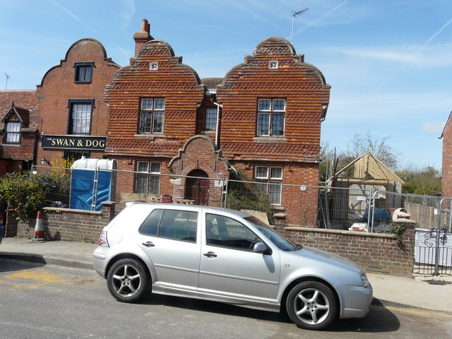
Image: © John Baker Taken: 12 Apr 2015
Planning permission has been granted by Ashford Borough Council under application number 15/00127/AS for the “erection of two storey rear extension, erection of garage and replacement of windows to dwelling (revised scheme to approved 11/01012/AS) (part retrospective)”. This shows Image after the alterations were completed.
Images are licensed for reuse under creativecommons.org/licenses/by-sa/2.0
Image Location
Latitude
51.14437
Longitude
0.832741