All Saints' church, Willian
Introduction
The photograph on this page of All Saints' church, Willian by Bikeboy as part of the Geograph project.
The Geograph project started in 2005 with the aim of publishing, organising and preserving representative images for every square kilometre of Great Britain, Ireland and the Isle of Man.

There are currently over 7.5m images from over 14,400 individuals and you can help contribute to the project by visiting https://www.geograph.org.uk
All Saints' church, Willian
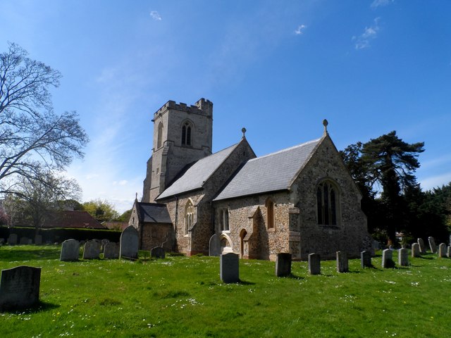
Image: © Bikeboy Taken: 4 May 2015
The nave and chancel are early C12. The tower was built around 1430. The west wall of the nave was taken down at this time and the nave extended by about 4 feet to meet the tower. The south porch seen here facing the camera was added in C15. No substantial C19 restoration was carried out but the chancel was probably extended at this time.
Images are licensed for reuse under creativecommons.org/licenses/by-sa/2.0
Image Location
Latitude
51.960857
Longitude
-0.219275