
Chichester Ship Canal - Poyntz Swing Bridge
Introduction
The photograph on this page of Chichester Ship Canal - Poyntz Swing Bridge by Rob Farrow as part of the Geograph project.
The Geograph project started in 2005 with the aim of publishing, organising and preserving representative images for every square kilometre of Great Britain, Ireland and the Isle of Man.

There are currently over 7.5m images from over 14,400 individuals and you can help contribute to the project by visiting https://www.geograph.org.uk
Chichester Ship Canal - Poyntz Swing Bridge
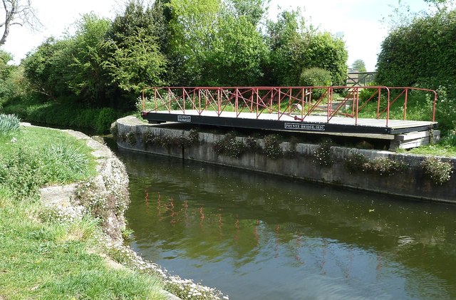
Image: © Rob Farrow Taken: 4 May 2015
Poyntz Swing Bridge has two plaques across its beam, they read: (left) C&H Tickell, Southampton (right) Poyntz Bridge, 1820 C(harles) & H(ugh) Tickell was the foundry where the ironwork for the bridge was produced. See http://www.gracesguide.co.uk/C._and_H._Tickell Originally this bridge was situated about a mile south of its current position just north of Hunston at a place which is still called "Poyntz Bridge". This is where there is a 90° kink in the canal. This kink exists because originally this section of the canal to Chichester was a spur linking up to the now-non-existent Portsmouth and Arundel Canal at the aforementioned kink near Hunston. It was in its original position until 1982 when it broke; the West Sussex County Council transferred it to the Sussex Industrial Archaeology Society. The volunteers at the SIAS spent nearly 15 years restoring it to full working order. It was moved here to the site of the former Padwick Bridge, and was opened in 1997 by the Mayor of Chichester to mark the 175th anniversary of the opening of the canal. To see the bridge in context see Image]
Images are licensed for reuse under creativecommons.org/licenses/by-sa/2.0
Image Location

Latitude
50.828177
Longitude
-0.780998