New Ards and North Down boundary sign near Dundonald (May 2015)
Introduction
The photograph on this page of New Ards and North Down boundary sign near Dundonald (May 2015) by Albert Bridge as part of the Geograph project.
The Geograph project started in 2005 with the aim of publishing, organising and preserving representative images for every square kilometre of Great Britain, Ireland and the Isle of Man.

There are currently over 7.5m images from over 14,400 individuals and you can help contribute to the project by visiting https://www.geograph.org.uk
New Ards and North Down boundary sign near Dundonald (May 2015)
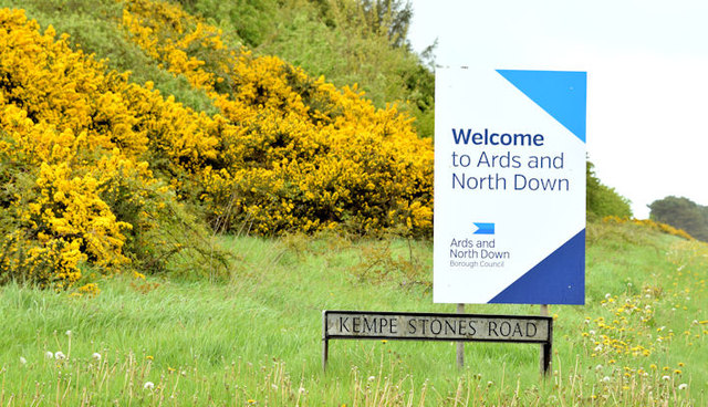
Image: © Albert Bridge Taken: 11 May 2015
On 1 April 2015 local government was re-organised with most council areas (except Belfast) being amalgamated into larger districts. This sign, beside the dual carriageway, is at the boundary between the new Lisburn & Castlereagh and Ards & North Down districts – previously Castlereagh and Ards districts. It replaces one similar to this Image Before the formal boundary alterations “shadow” councils existed to plan the changeover.
Images are licensed for reuse under creativecommons.org/licenses/by-sa/2.0
Image Location
Latitude
54.593885
Longitude
-5.767156