Precipitation Pond
Introduction
The photograph on this page of Precipitation Pond by Chris Andrews as part of the Geograph project.
The Geograph project started in 2005 with the aim of publishing, organising and preserving representative images for every square kilometre of Great Britain, Ireland and the Isle of Man.

There are currently over 7.5m images from over 14,400 individuals and you can help contribute to the project by visiting https://www.geograph.org.uk
Precipitation Pond
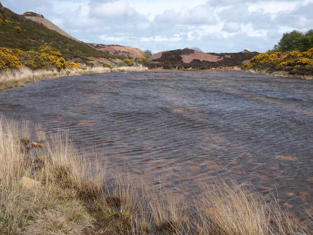
Image: © Chris Andrews Taken: 10 May 2015
Copper rich solutions from mining activities on Parys Mountain were collected in these pools. Iron was then placed in the pools, resulting in the precipitation of Copper. (i.e. if the copper is in a sulphate compound, then a simple reaction is: CuSO4 + Fe (Metal) = FeSO4 + Cu (Metal))
Images are licensed for reuse under creativecommons.org/licenses/by-sa/2.0
Image Location
Latitude
53.381448
Longitude
-4.34924