Berrybrae Recumbent Stone Circle (4)
Introduction
The photograph on this page of Berrybrae Recumbent Stone Circle (4) by Anne Burgess as part of the Geograph project.
The Geograph project started in 2005 with the aim of publishing, organising and preserving representative images for every square kilometre of Great Britain, Ireland and the Isle of Man.

There are currently over 7.5m images from over 14,400 individuals and you can help contribute to the project by visiting https://www.geograph.org.uk
Berrybrae Recumbent Stone Circle (4)
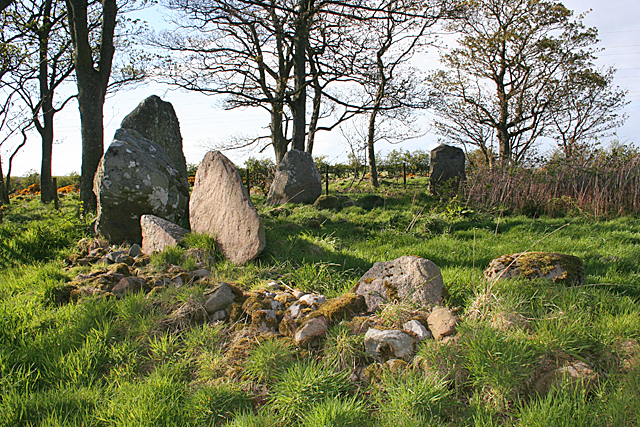
Image: © Anne Burgess Taken: 7 May 2015
All the surviving stones are in the west arc of the circle. The large dark one on the left is the recumbent, with the broken east flanker in front of it. The next one is still in its original position, but the one furthest to the right has been re-erected after falling over. See http://canmore.rcahms.gov.uk/en/site/21099/details/berrybrae/ for more information. Image]
Images are licensed for reuse under creativecommons.org/licenses/by-sa/2.0
Image Location
Latitude
57.604348
Longitude
-1.955476