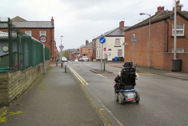
Pinch-point on Henry Street
Introduction
The photograph on this page of Pinch-point on Henry Street by Gerald England as part of the Geograph project.
The Geograph project started in 2005 with the aim of publishing, organising and preserving representative images for every square kilometre of Great Britain, Ireland and the Isle of Man.
There are currently over 7.5m images from over 14,400 individuals and you can help contribute to the project by visiting https://www.geograph.org.uk

Image: © Gerald England Taken: 6 May 2015
Henry Street and its continuation Higher Henry Street used to be used as a "rat run" (as such routes are called) for traffic between Dowson Road and Manchester Road wanting to avoid the main road through the town centre. The "traffic-calming" measures introduced some years ago involved creating a "pinch-point" here where the road is reduced to 6 feet 6 inches width to prevent HGVs accessing the road. Various sections were made "one-way" so it became no longer a direct "through-route". Wheelchair users are often forced to use the road as the pavements are blocked by parked cars and wheelie-bins.

