The Wales Coast Path between Kenfig Nature Reserve and Margam Moors
Introduction
The photograph on this page of The Wales Coast Path between Kenfig Nature Reserve and Margam Moors by eswales as part of the Geograph project.
The Geograph project started in 2005 with the aim of publishing, organising and preserving representative images for every square kilometre of Great Britain, Ireland and the Isle of Man.

There are currently over 7.5m images from over 14,400 individuals and you can help contribute to the project by visiting https://www.geograph.org.uk
The Wales Coast Path between Kenfig Nature Reserve and Margam Moors
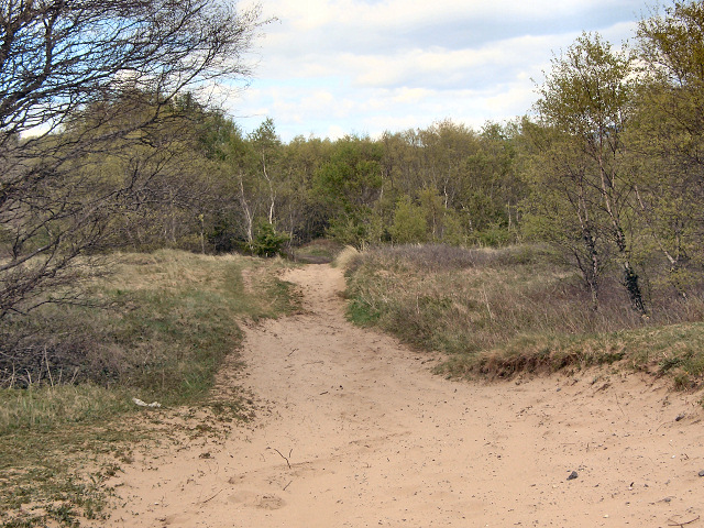
Image: © eswales Taken: 30 Apr 2015
On a stretch of the Wales Coast Path between the footbridge over the River Kenfig and the southern end of Margam Moors. The area through which this stretch passes can be described as duneland, and the path is often of soft sand. Walking on such a surface can be energy sapping though some of the worst bits here can be skirted. In the image, the path is seen heading towards an area of woodland. Once this is reached, the path becomes less sandy and the walking easier (unless, that is, the path is affected by flooding at Margam Moors – as some notices further south warn it can be following severe weather).
Images are licensed for reuse under creativecommons.org/licenses/by-sa/2.0
Image Location
Latitude
51.537269
Longitude
-3.748329