Church Street
Introduction
The photograph on this page of Church Street by Ian Capper as part of the Geograph project.
The Geograph project started in 2005 with the aim of publishing, organising and preserving representative images for every square kilometre of Great Britain, Ireland and the Isle of Man.

There are currently over 7.5m images from over 14,400 individuals and you can help contribute to the project by visiting https://www.geograph.org.uk
Church Street
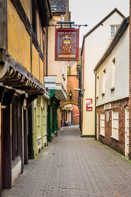
Image: © Ian Capper Taken: 10 Apr 2015
Historically, what is now High Street was much wider and was where the market was held, but over time the traders' stalls took on a permanent form, resulting in the narrow side streets that now run parallel to it: Market Street to the south and Harp Lane and Church Street to the north. This is Church Street, the northernmost of these streets; the buildings on the left divide it from Harp Lane (see Image). The sign is for the Rose and Crown pub - see Image
Images are licensed for reuse under creativecommons.org/licenses/by-sa/2.0
Image Location


Leaflet Map data © OpenStreetMap
Latitude
52.367724
Longitude
-2.719435