Railway viaduct over Penrose Street
Introduction
The photograph on this page of Railway viaduct over Penrose Street by Stephen Craven as part of the Geograph project.
The Geograph project started in 2005 with the aim of publishing, organising and preserving representative images for every square kilometre of Great Britain, Ireland and the Isle of Man.

There are currently over 7.5m images from over 14,400 individuals and you can help contribute to the project by visiting https://www.geograph.org.uk
Railway viaduct over Penrose Street
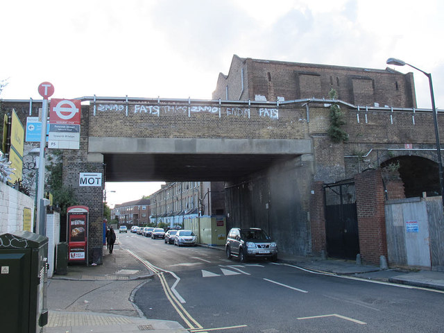
Image: © Stephen Craven Taken: 29 Apr 2015
The bridge is part of the "Thameslink" viaduct running south from Blackfriars. This arch has obviously been rebuild with a flat concrete soffit, presumably after being damaged by the same bomb that destroyed the adjacent power station Image Unusually there is no height warning shown. The view also shows a bus stop and telephone box.
Images are licensed for reuse under creativecommons.org/licenses/by-sa/2.0
Image Location
Latitude
51.48748
Longitude
-0.097053