Disused building on the corner of Occupation Road
Introduction
The photograph on this page of Disused building on the corner of Occupation Road by Stephen Craven as part of the Geograph project.
The Geograph project started in 2005 with the aim of publishing, organising and preserving representative images for every square kilometre of Great Britain, Ireland and the Isle of Man.

There are currently over 7.5m images from over 14,400 individuals and you can help contribute to the project by visiting https://www.geograph.org.uk
Disused building on the corner of Occupation Road
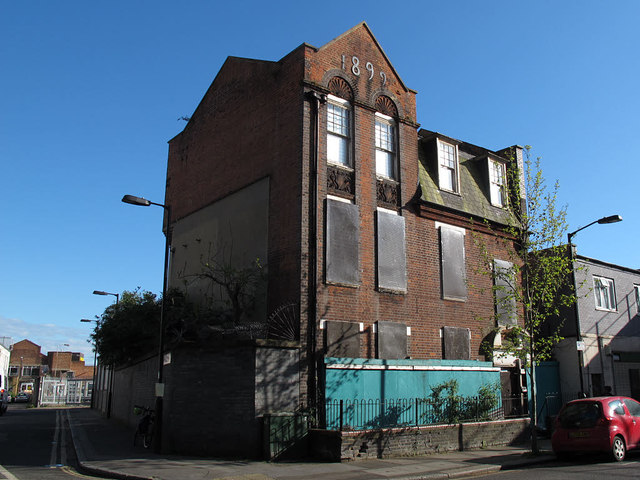
Image: © Stephen Craven Taken: 29 Apr 2015
This three-storey brick building on the corner of Occupation Road and Manor Place has a prominent date - 1899 - but as of 2015 was abandoned, one of many buildings that would be demolished if a current planning application for the Manor Place develompent goes ahead.
Images are licensed for reuse under creativecommons.org/licenses/by-sa/2.0
Image Location
Latitude
51.488928
Longitude
-0.097569