Brackagh Bog
Introduction
The photograph on this page of Brackagh Bog by Robert Ashby as part of the Geograph project.
The Geograph project started in 2005 with the aim of publishing, organising and preserving representative images for every square kilometre of Great Britain, Ireland and the Isle of Man.

There are currently over 7.5m images from over 14,400 individuals and you can help contribute to the project by visiting https://www.geograph.org.uk
Brackagh Bog
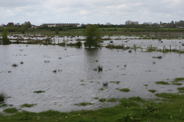
Image: © Robert Ashby Taken: 4 May 2015
A small area of wetland - in this case with added water from recent heavy rain - to the south of Portadown, the result of 200 years of peat extraction. Bounded by the River Bann to the east and the housing developments on slightly higher ground on the Tandragee Road to the west with the Belfast-Dublin railway line running across on a raised embankment just visible between the flood-water and the slightly higher housing.
Images are licensed for reuse under creativecommons.org/licenses/by-sa/2.0
Image Location
Latitude
54.414688
Longitude
-6.433481