30 and 32 Mill Road
Introduction
The photograph on this page of 30 and 32 Mill Road by Alan Murray-Rust as part of the Geograph project.
The Geograph project started in 2005 with the aim of publishing, organising and preserving representative images for every square kilometre of Great Britain, Ireland and the Isle of Man.

There are currently over 7.5m images from over 14,400 individuals and you can help contribute to the project by visiting https://www.geograph.org.uk
30 and 32 Mill Road
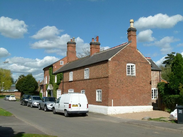
Image: © Alan Murray-Rust Taken: 28 Apr 2015
Built in 1743 as a single unit but apparently always a pair of separate dwellings. The original building was the lower section, originally a single storey building, the upper floor being added in the 19th century. No.30 is nearest the camera; no.32 originally comprised the part beyond the central chimney stack, and has a datestone inscribed 1743. To this was added the higher part of the building sometime in the 19th century. Listed Grade II as a single unit.
Images are licensed for reuse under creativecommons.org/licenses/by-sa/2.0
Image Location
Latitude
52.723719
Longitude
-1.039921