Watchtower, Burgh by Sands
Introduction
The photograph on this page of Watchtower, Burgh by Sands by Rose and Trev Clough as part of the Geograph project.
The Geograph project started in 2005 with the aim of publishing, organising and preserving representative images for every square kilometre of Great Britain, Ireland and the Isle of Man.

There are currently over 7.5m images from over 14,400 individuals and you can help contribute to the project by visiting https://www.geograph.org.uk
Watchtower, Burgh by Sands
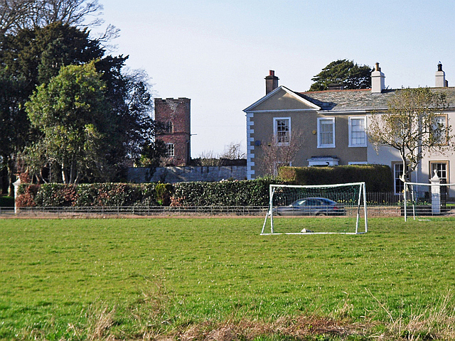
Image: © Rose and Trev Clough Taken: 21 Mar 2015
This is a zoom shot from the village green - it wasn't possible to get a closer look because the building is in someone's garden. The tower is thought to have been built in the late 18th century, as a lookout for excise officers trying to control the smuggling which was rife along the Solway Firth at that time. For more information see http://www.imagesofengland.org.uk/details/default.aspx?id=78222 .
Images are licensed for reuse under creativecommons.org/licenses/by-sa/2.0
Image Location


Leaflet Map data © OpenStreetMap
Latitude
54.922359
Longitude
-3.055784