St Vincent Street, Broughty Ferry
Introduction
The photograph on this page of St Vincent Street, Broughty Ferry by Elliott Simpson as part of the Geograph project.
The Geograph project started in 2005 with the aim of publishing, organising and preserving representative images for every square kilometre of Great Britain, Ireland and the Isle of Man.

There are currently over 7.5m images from over 14,400 individuals and you can help contribute to the project by visiting https://www.geograph.org.uk
St Vincent Street, Broughty Ferry
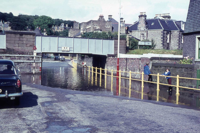
Image: © Elliott Simpson Taken: 1 Aug 1966
The dip under the bridge flooded frequently in the 1960s. Don't know if it does still.
Images are licensed for reuse under creativecommons.org/licenses/by-sa/2.0
Image Location
Latitude
56.467275
Longitude
-2.869422