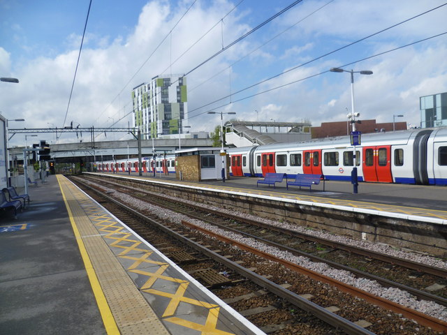
Barking station
Introduction
The photograph on this page of Barking station by Marathon as part of the Geograph project.
The Geograph project started in 2005 with the aim of publishing, organising and preserving representative images for every square kilometre of Great Britain, Ireland and the Isle of Man.
There are currently over 7.5m images from over 14,400 individuals and you can help contribute to the project by visiting https://www.geograph.org.uk

Image: © Marathon Taken: 29 Apr 2015
Barking station was opened on 13th April 1854 by the London Tilbury & Southend Railway (LTSR) on their new line to Tilbury via Dagenham Dock, which split from the Eastern Counties Railway (ECR) at Forest Gate. This is now part of the C2C line from Barking via Dagenham Dock and Rainham to Grays. The London, Tilbury & Southend Railway (LTSR) direct line from Bow to Barking (avoiding Stratford and Forest Gate) was constructed from west to east in 1858. What is now the main C2C line was opened in 1885 by the London, Tilbury & Southend Railway between Barking and Upminster. On 12th September 1932, the District line was extended over new tracks alongside the existing line between Barking and Upminster. The present main C2C line therefore dates from 1885 and the present District line from 1932. They are all pre-dated by the Dagenham Dock branch of the C2C line which opened in 1854. The Hammersmith & City (at that time part of the Metropolitan line) first served the station in 1936. For a more detailed history see http://en.wikipedia.org/wiki/Barking_station This photograph from the up C2C line sees a Hammersmith & City line train terminating on the far side. The bridge ahead carries the Northern Relief Road over the lines.

