Burst water main!
Introduction
The photograph on this page of Burst water main! by Richard Sutcliffe as part of the Geograph project.
The Geograph project started in 2005 with the aim of publishing, organising and preserving representative images for every square kilometre of Great Britain, Ireland and the Isle of Man.

There are currently over 7.5m images from over 14,400 individuals and you can help contribute to the project by visiting https://www.geograph.org.uk
Burst water main!
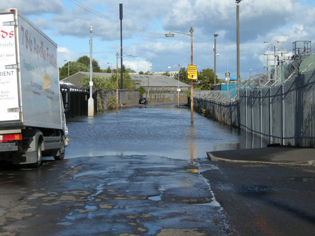
Image: © Richard Sutcliffe Taken: 8 Aug 2011
Woodhead Road flooded after a water main burst. The yellow sign for Glasgow Museums Resource Centre should be facing the other way round; it's actually behind the photographer.
Images are licensed for reuse under creativecommons.org/licenses/by-sa/2.0
Image Location
Latitude
55.810584
Longitude
-4.360036