Whitcliffe Cottages
Introduction
The photograph on this page of Whitcliffe Cottages by Ian Capper as part of the Geograph project.
The Geograph project started in 2005 with the aim of publishing, organising and preserving representative images for every square kilometre of Great Britain, Ireland and the Isle of Man.

There are currently over 7.5m images from over 14,400 individuals and you can help contribute to the project by visiting https://www.geograph.org.uk
Whitcliffe Cottages
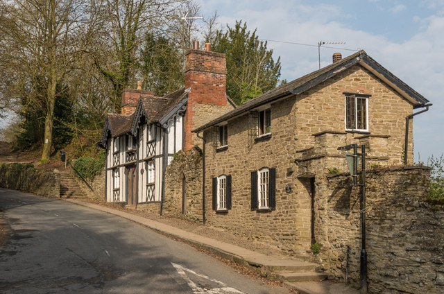
Image: © Ian Capper Taken: 10 Apr 2015
Grade II listed cottages on Whitcliffe Road. The nearer one dates from the early 19th century while the one beyond, originally two houses, dates from the mid 19th century - for listing particulars see www.historicengland.org.uk/listing/the-list/list-entry/1202821 and www.historicengland.org.uk/listing/the-list/list-entry/1202822 respectively. The steps beyond are the footpath that leads over Whitcliffe and links with the Bread Walk to Dinham Bridge.
Images are licensed for reuse under creativecommons.org/licenses/by-sa/2.0
Image Location
Latitude
52.363204
Longitude
-2.717613