Shelter, Low Worsall
Introduction
The photograph on this page of Shelter, Low Worsall by Mick Garratt as part of the Geograph project.
The Geograph project started in 2005 with the aim of publishing, organising and preserving representative images for every square kilometre of Great Britain, Ireland and the Isle of Man.

There are currently over 7.5m images from over 14,400 individuals and you can help contribute to the project by visiting https://www.geograph.org.uk
Shelter, Low Worsall
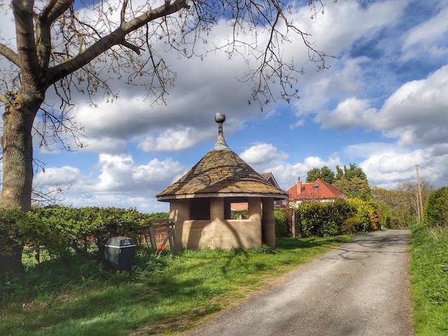
Image: © Mick Garratt Taken: 28 Apr 2015
A Grade II Listed building, see http://www.britishlistedbuildings.co.uk/en-331914-shelter-low-worsall-north-yorkshire#.VUDeQc55ZS8 Probably 1920s. Ashlar with graduated stone slate roof, tall lead ball finial. Small circular building with entrance flanked by an open panel at either side, the door jambs and panel divisions circular on plan. Radial stone floor paving, eight radial joists support an octagonal king post against which are closely abutted the rafters which show at the eaves, ashlared to give a sweep to the roof. Inscription on rear wall: In memory of Edward and Mary Temple.
Images are licensed for reuse under creativecommons.org/licenses/by-sa/2.0
Image Location
Latitude
54.484236
Longitude
-1.393126