Dorking: Knoll Road
Introduction
The photograph on this page of Dorking: Knoll Road by Dr Neil Clifton as part of the Geograph project.
The Geograph project started in 2005 with the aim of publishing, organising and preserving representative images for every square kilometre of Great Britain, Ireland and the Isle of Man.

There are currently over 7.5m images from over 14,400 individuals and you can help contribute to the project by visiting https://www.geograph.org.uk
Dorking: Knoll Road
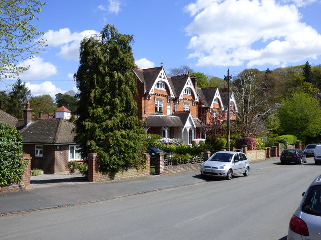
Image: © Dr Neil Clifton Taken: 28 Apr 2015
These excellent pan-tiled Edwardian houses are good surviving examples of the type, suitable for a well-to-do family to live in comfort. These are numbered from 2 (far end) to 10, which is actually five houses (No 6 is part of No 8).
Images are licensed for reuse under creativecommons.org/licenses/by-sa/2.0
Image Location
Latitude
51.222105
Longitude
-0.332997