End of new cycle lane at the Royal Standard
Introduction
The photograph on this page of End of new cycle lane at the Royal Standard by Stephen Craven as part of the Geograph project.
The Geograph project started in 2005 with the aim of publishing, organising and preserving representative images for every square kilometre of Great Britain, Ireland and the Isle of Man.

There are currently over 7.5m images from over 14,400 individuals and you can help contribute to the project by visiting https://www.geograph.org.uk
End of new cycle lane at the Royal Standard
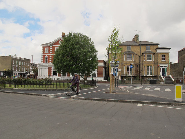
Image: © Stephen Craven Taken: 25 Apr 2015
In response to a request from a local cycling campaign group, Greenwich Council put in this cycle lane in April 2015 to allow cyclists a short-cut from Vanbrugh Park to Old Dover Road - effectively going straight across the junction, whereas motor traffic has to take a 300m detour around the gyratory system. Although indicated as a segregated (cycle only) lane, with pedestrians intended to use two zebra crossings and one pelican to cross the junction, as can be seen in Image many pedestrians were already using the cycle lane although they then face a more dangerous unsignalled crossing of the main road to get back on the pavement. Subsequent to this photo, a "tiger crossing" (unsignalled) was marked on the road to deter this use.
Images are licensed for reuse under creativecommons.org/licenses/by-sa/2.0
Image Location
Latitude
51.477171
Longitude
0.019308