Shut Lane Mill marker, Coventry
Introduction
The photograph on this page of Shut Lane Mill marker, Coventry by Jaggery as part of the Geograph project.
The Geograph project started in 2005 with the aim of publishing, organising and preserving representative images for every square kilometre of Great Britain, Ireland and the Isle of Man.

There are currently over 7.5m images from over 14,400 individuals and you can help contribute to the project by visiting https://www.geograph.org.uk
Shut Lane Mill marker, Coventry
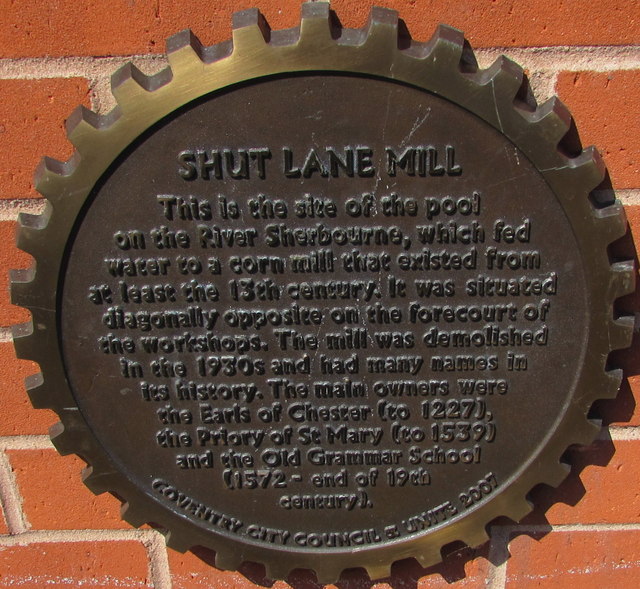
Image: © Jaggery Taken: 18 Apr 2015
Located on the Gulson Road side of this http://www.geograph.org.uk/photo/4444936 Unite Students building. The marker records the site of the pool on the River Sherbourne, which fed water to a corn mill that existed from at least the 13th century. The mill was demolished in the 1930s.
Images are licensed for reuse under creativecommons.org/licenses/by-sa/2.0
Image Location
Latitude
52.40551
Longitude
-1.497533