Down Hollowstone
Introduction
The photograph on this page of Down Hollowstone by John Sutton as part of the Geograph project.
The Geograph project started in 2005 with the aim of publishing, organising and preserving representative images for every square kilometre of Great Britain, Ireland and the Isle of Man.

There are currently over 7.5m images from over 14,400 individuals and you can help contribute to the project by visiting https://www.geograph.org.uk
Down Hollowstone
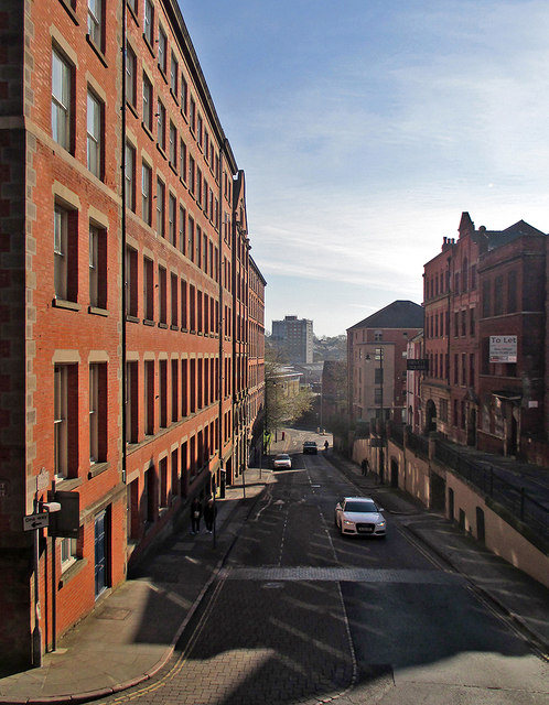
Image: © John Sutton Taken: 22 Apr 2015
This was once the main route into the centre of Nottingham from the east, and the road level was lowered in the eighteenth century to ease the passage of horse-drawn wagons. Short Hill, in shadow on the right, shows the original road level. In the nineteenth century huge warehouses like the one on the left (now student flats) were built all over the Lace Market. The bright light of an April morning shows just how orange Nottingham-made brick is. The picture was taken from St Mary's churchyard: Image] is the view up Hollowstone (or Hollow Stone) from Short Hill.
Images are licensed for reuse under creativecommons.org/licenses/by-sa/2.0
Image Location
Latitude
52.951219
Longitude
-1.141612