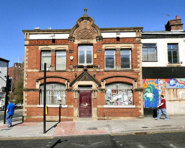
Unity Inn
Introduction
The photograph on this page of Unity Inn by Gerald England as part of the Geograph project.
The Geograph project started in 2005 with the aim of publishing, organising and preserving representative images for every square kilometre of Great Britain, Ireland and the Isle of Man.
There are currently over 7.5m images from over 14,400 individuals and you can help contribute to the project by visiting https://www.geograph.org.uk

Image: © Gerald England Taken: 18 Apr 2015
The Unity Inn is a locally listed building. An early 19th century public house with an engaging well-designed front of circa 1888, it is characterised by finely carved stone detailing and terracotta. The pub is said to have been named for the Oddfellows Hall which stood nearby. It was first recorded in 1858, and refronted in the late 1880s. Brick with stone dressings, slate roof. Symmetrical frontage, two storeys. Central entrance with a pedimental top with carved foliage in the tympanum, paired colonettes with foliated caps on each side. This is flanked by windows with wide segmental heads. Paired upper windows on each side share a stone lintel and are divided by a brick pier with a foliated stone cap. Above is a decorative red terracotta frieze. A central shaped gable has a ball finial and carving in red sandstone within it with the words "Unity Inn" and a vase with flowers. It was a Robinsons pub Image but was closed around 2013 Image

