
Paleokarst surface, Trowbarrow LNR
Introduction
The photograph on this page of Paleokarst surface, Trowbarrow LNR by Karl and Ali as part of the Geograph project.
The Geograph project started in 2005 with the aim of publishing, organising and preserving representative images for every square kilometre of Great Britain, Ireland and the Isle of Man.

There are currently over 7.5m images from over 14,400 individuals and you can help contribute to the project by visiting https://www.geograph.org.uk
Paleokarst surface, Trowbarrow LNR
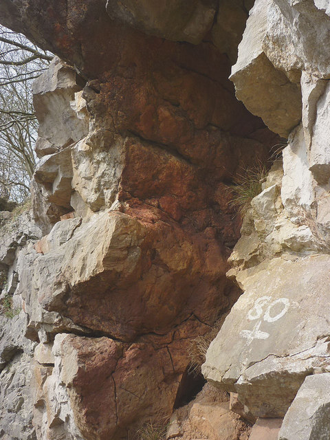
Image: © Karl and Ali Taken: 17 Apr 2015
The reddish coloured face is a small fragment of limestone pavement, similar to many found in the area. The biggest difference here is that this example formed millions of years ago, was subsequently buried and then tilted vertically by earth movements of the Urswick Limestone. Other limestone pavements in the area were all formed within the last 15,000 years after the end of the last glacial period. The rock faces of the reserve are a SSSI for their geological interest.
Images are licensed for reuse under creativecommons.org/licenses/by-sa/2.0
Image Location

Latitude
54.177859
Longitude
-2.797562