Bingley Weir and Ireland Bridge
Introduction
The photograph on this page of Bingley Weir and Ireland Bridge by David Dixon as part of the Geograph project.
The Geograph project started in 2005 with the aim of publishing, organising and preserving representative images for every square kilometre of Great Britain, Ireland and the Isle of Man.

There are currently over 7.5m images from over 14,400 individuals and you can help contribute to the project by visiting https://www.geograph.org.uk
Bingley Weir and Ireland Bridge
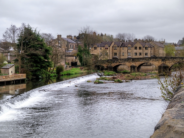
Image: © David Dixon Taken: 15 Apr 2015
Bingley was founded at a ford on the River Aire, probably in Saxon times. This crossing gave access to Harden, Cullingworth and Wilsden on the south side of the river. The ford was superseded by Ireland Bridge In mediæval times. The present bridge is grade II*-listed as “a large elegant well-preserved bridge in virtually unaltered condition” (ENGLISH HERITAGE BUILDING ID: 337905 http://www.britishlistedbuildings.co.uk/en-337905-ireland-bridge-#.VTSx32d0x_s British Listed Buildings). It was rebuilt in 1686 and the parapet may be eighteenth century.
Images are licensed for reuse under creativecommons.org/licenses/by-sa/2.0
Image Location
Latitude
53.850731
Longitude
-1.841874