OS benchmark - Sytch House Green
Introduction
The photograph on this page of OS benchmark - Sytch House Green by Richard Law as part of the Geograph project.
The Geograph project started in 2005 with the aim of publishing, organising and preserving representative images for every square kilometre of Great Britain, Ireland and the Isle of Man.

There are currently over 7.5m images from over 14,400 individuals and you can help contribute to the project by visiting https://www.geograph.org.uk
OS benchmark - Sytch House Green
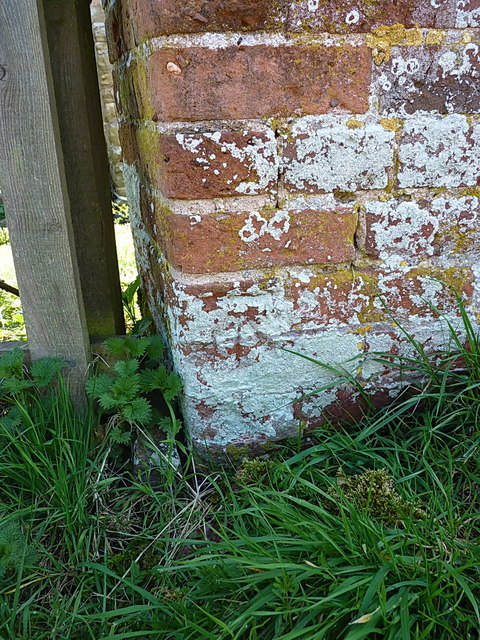
Image: © Richard Law Taken: 6 Apr 2015
A rather unclear OS cutmark on the boundary/garden wall of a house at Sytch House Green - it's on the 3rd brick course from the ground and supported by the traditional 3-cut arrow beneath it, between the 2nd & 3rd courses. Originally levelled at 91.419m above Ordnance Datum Newlyn.
Images are licensed for reuse under creativecommons.org/licenses/by-sa/2.0
Image Location
Latitude
52.51461
Longitude
-2.322344