Trewen Mill
Introduction
The photograph on this page of Trewen Mill by Derek Harper as part of the Geograph project.
The Geograph project started in 2005 with the aim of publishing, organising and preserving representative images for every square kilometre of Great Britain, Ireland and the Isle of Man.

There are currently over 7.5m images from over 14,400 individuals and you can help contribute to the project by visiting https://www.geograph.org.uk
Trewen Mill
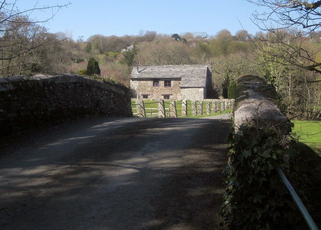
Image: © Derek Harper Taken: 14 Apr 2015
Seen from the listed bridge http://list.historicengland.org.uk/resultsingle.aspx?uid=1263382&searchtype=mapsearch over the River Inny. The mill is also listed http://list.historicengland.org.uk/resultsingle.aspx?uid=1263383&searchtype=mapsearch . It was fed by a leat down the far side of the valley floor.
Images are licensed for reuse under creativecommons.org/licenses/by-sa/2.0
Image Location


Leaflet Map data © OpenStreetMap
Latitude
50.621787
Longitude
-4.472651