The Ford near Chobham
Introduction
The photograph on this page of The Ford near Chobham by Ron Strutt as part of the Geograph project.
The Geograph project started in 2005 with the aim of publishing, organising and preserving representative images for every square kilometre of Great Britain, Ireland and the Isle of Man.

There are currently over 7.5m images from over 14,400 individuals and you can help contribute to the project by visiting https://www.geograph.org.uk
The Ford near Chobham
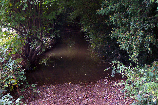
Image: © Ron Strutt Taken: 28 Sep 2003
This has to be one of the most unusual fords ever. Rather than simply crossing the road, the stream flows along the lane for nearly 200 yards. Once a well-used thoroughfare, the stream has gradually scoured away the track and although the highways authority has tried to repair the situation by dumping thousands of tons of gravel to level out the stream bed, it has now admitted defeat and has closed the road to traffic. Horses (cyclists and walkers, too, if they should feel so foolhardy) are still allowed to use it though.
Images are licensed for reuse under creativecommons.org/licenses/by-sa/2.0
Image Location


Leaflet Map data © OpenStreetMap
Latitude
51.353391
Longitude
-0.615605