Winsford Salt Mine #4 Shaft
Introduction
The photograph on this page of Winsford Salt Mine #4 Shaft by Mike Harris as part of the Geograph project.
The Geograph project started in 2005 with the aim of publishing, organising and preserving representative images for every square kilometre of Great Britain, Ireland and the Isle of Man.

There are currently over 7.5m images from over 14,400 individuals and you can help contribute to the project by visiting https://www.geograph.org.uk
Winsford Salt Mine #4 Shaft
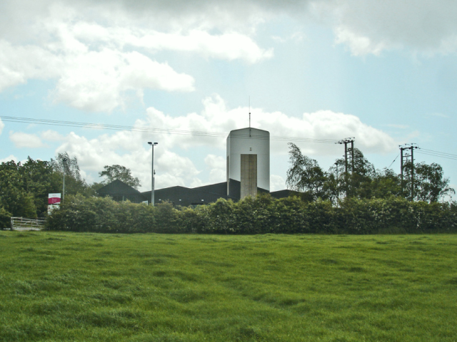
Image: © Mike Harris Taken: 19 May 2007
Winsford Salt Mine #4 Shaft #4. Seen from the footpath from Jack Lane, along the Bostock / Moulton boundary. The location of this shaft gives some idea of the extent of the underground workings of the Winsford salt mine. The main shaft and mine workings are over 1 km away to the SW. In fact the underground mine workings are far more extensive even than this.
Images are licensed for reuse under creativecommons.org/licenses/by-sa/2.0
Image Location
Latitude
53.214823
Longitude
-2.505661