Rooftops, Newtownards (April 2015)
Introduction
The photograph on this page of Rooftops, Newtownards (April 2015) by Albert Bridge as part of the Geograph project.
The Geograph project started in 2005 with the aim of publishing, organising and preserving representative images for every square kilometre of Great Britain, Ireland and the Isle of Man.

There are currently over 7.5m images from over 14,400 individuals and you can help contribute to the project by visiting https://www.geograph.org.uk
Rooftops, Newtownards (April 2015)
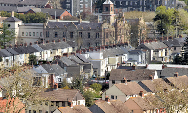
Image: © Albert Bridge Taken: 18 Apr 2015
Rooftops, around the Scrabo Road, seen from this path Image as it climbs towards Scrabo Tower. There are many such views along its length but some are obstructed by the high hedge. The Model School is at middle top.
Images are licensed for reuse under creativecommons.org/licenses/by-sa/2.0
Image Location
Latitude
54.590528
Longitude
-5.707769