Washington Limekilns
Introduction
The photograph on this page of Washington Limekilns by Peter Cox as part of the Geograph project.
The Geograph project started in 2005 with the aim of publishing, organising and preserving representative images for every square kilometre of Great Britain, Ireland and the Isle of Man.

There are currently over 7.5m images from over 14,400 individuals and you can help contribute to the project by visiting https://www.geograph.org.uk
Washington Limekilns
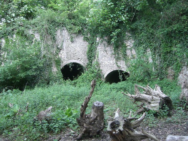
Image: © Peter Cox Taken: 18 May 2006
Reached by a footpath from the old Bostal road is this group of limekilns, probably five in total. On the other side of the footpath are the remains of a flint building and a levelled piece of ground probably to help loading onto waggons on the Bostal. There are pits nearby in the Lower Chalk (no flints, but with clay) at TQ133124 and TQ121121, as well as pits in the Upper and Middle Chalk (contains flints) at TQ126121.
Images are licensed for reuse under creativecommons.org/licenses/by-sa/2.0
Image Location
Latitude
50.89934
Longitude
-0.409682