Staines Reservoir Aqueduct from the "Old Cattle Bridge"
Introduction
The photograph on this page of Staines Reservoir Aqueduct from the "Old Cattle Bridge" by Sean Davis as part of the Geograph project.
The Geograph project started in 2005 with the aim of publishing, organising and preserving representative images for every square kilometre of Great Britain, Ireland and the Isle of Man.

There are currently over 7.5m images from over 14,400 individuals and you can help contribute to the project by visiting https://www.geograph.org.uk
Staines Reservoir Aqueduct from the "Old Cattle Bridge"
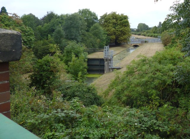
Image: © Sean Davis Taken: 24 Aug 2012
The aqueduct was built c1902 to feed the Staines Reservoirs which were constructed across the parish boundary in Stanwell a year earlier. It takes water from the River Thames at Hythe End, just above Bell Weir Lock. In later years it was used to feed the Hampton Water Works reservoirs at Kempton Park, plus the King George VI Reservoir built next to the Staines Reservoirs, between Staines and Stanwell and opened in 1947. The aqueduct continues to still feed all these reservoirs today. Overall it’s a wonderful piece of architecture passing over and under rivers, railways and roads.
Images are licensed for reuse under creativecommons.org/licenses/by-sa/2.0
Image Location
Latitude
51.440508
Longitude
-0.518527