Lychgate, Hunsingore
Introduction
The photograph on this page of Lychgate, Hunsingore by Derek Harper as part of the Geograph project.
The Geograph project started in 2005 with the aim of publishing, organising and preserving representative images for every square kilometre of Great Britain, Ireland and the Isle of Man.

There are currently over 7.5m images from over 14,400 individuals and you can help contribute to the project by visiting https://www.geograph.org.uk
Lychgate, Hunsingore
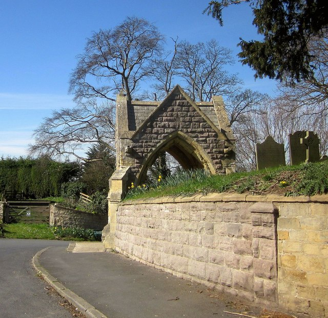
Image: © Derek Harper Taken: 6 Apr 2015
The distinctive lychgate, dated 1867, is also shown in Image and Image "The church was rebuilt in 1867 and the lychgate is built against the mound of the old church. Its design therefore allows for passage through the south and west sides of the structure instead of the usual direct route through south and north" http://list.historicengland.org.uk/resultsingle.aspx?uid=1294112&searchtype=mapsearch . Because of its prominent position, the lychgate is a key component in views along the main lanes through the village, particularly up Main Street from the south.
Images are licensed for reuse under creativecommons.org/licenses/by-sa/2.0
Image Location


Leaflet Map data © OpenStreetMap
Latitude
53.975973
Longitude
-1.347718