
Tadley Telephone Exchange
Introduction
The photograph on this page of Tadley Telephone Exchange by David Hillas as part of the Geograph project.
The Geograph project started in 2005 with the aim of publishing, organising and preserving representative images for every square kilometre of Great Britain, Ireland and the Isle of Man.

There are currently over 7.5m images from over 14,400 individuals and you can help contribute to the project by visiting https://www.geograph.org.uk
Tadley Telephone Exchange
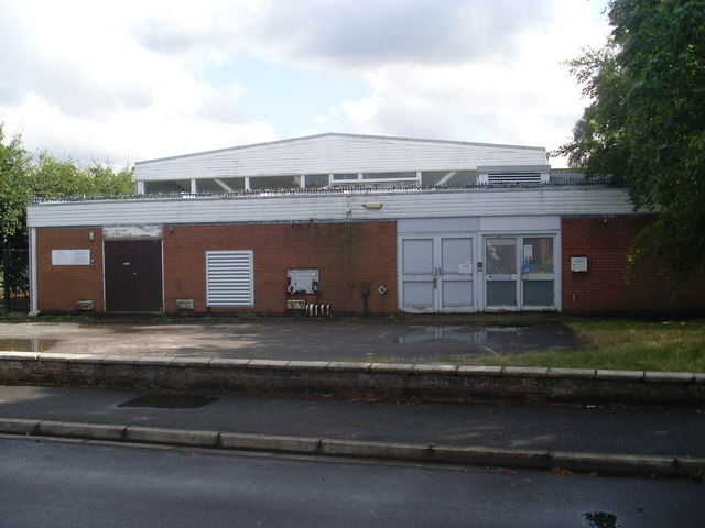
Image: © David Hillas Taken: 2 Aug 2014
Situated in Newchurch Road, this TE would appear to date from the late 1960s and has the code THTAD. It can be recognised by the two BT warning notices on the building to the left of the photo. This TE serves 6,170 residential and 338 non-residential premises in Tadley, plus Aldermaston, Baughurst, Heath End and Pamber Green nearby. The building itself perhaps could do with a facelift to smarten its appearance. It has numbering ranges (01189) 81xxxx, 82xxxx, the (01189) referring to the Reading group of TEs, and its postcode is RG26 4HN.
Images are licensed for reuse under creativecommons.org/licenses/by-sa/2.0
Image Location

Latitude
51.354467
Longitude
-1.153682