Flood control on the approach to Erith Pier
Introduction
The photograph on this page of Flood control on the approach to Erith Pier by Marathon as part of the Geograph project.
The Geograph project started in 2005 with the aim of publishing, organising and preserving representative images for every square kilometre of Great Britain, Ireland and the Isle of Man.

There are currently over 7.5m images from over 14,400 individuals and you can help contribute to the project by visiting https://www.geograph.org.uk
Flood control on the approach to Erith Pier
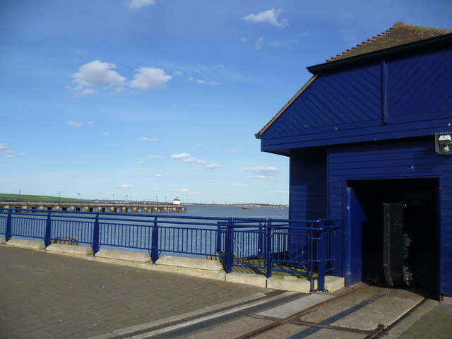
Image: © Marathon Taken: 11 Apr 2015
Erith Pier was built in the late 1950s as a deep water facility when the previous wooden piers at Erith had outlived their usefulness. In the early 1990s the complex was abandoned until Morrisons took over in 1999, building a supermarket and restoring the concrete pier as a public amenity. It is the longest pier on the River Thames in London and provides superb views of the river. This building ohouses a gate which can be slid across the access to the pier when there is a risk of flooding. Another view of it can be seen at http://www.geograph.org.uk/photo/2328461
Images are licensed for reuse under creativecommons.org/licenses/by-sa/2.0
Image Location
Latitude
51.480975
Longitude
0.183375