Kirk Hill
Introduction
The photograph on this page of Kirk Hill by Anne Burgess as part of the Geograph project.
The Geograph project started in 2005 with the aim of publishing, organising and preserving representative images for every square kilometre of Great Britain, Ireland and the Isle of Man.

There are currently over 7.5m images from over 14,400 individuals and you can help contribute to the project by visiting https://www.geograph.org.uk
Kirk Hill
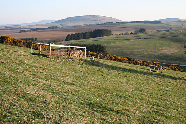
Image: © Anne Burgess Taken: 9 Apr 2015
In the foreground is a concrete structure that is probably a water supply for Upper Hassiewells. The sharp peak of the Mither Tap of Bennachie is on the skyline at left. In the middle is the Hill of Tillymorgan, and the Hill of Skares is on the right, just visible above Wether Hill.
Images are licensed for reuse under creativecommons.org/licenses/by-sa/2.0
Image Location
Latitude
57.442952
Longitude
-2.58007