The New River near the Bowes Park Tunnel seen from the New River Path
Introduction
The photograph on this page of The New River near the Bowes Park Tunnel seen from the New River Path by Marathon as part of the Geograph project.
The Geograph project started in 2005 with the aim of publishing, organising and preserving representative images for every square kilometre of Great Britain, Ireland and the Isle of Man.

There are currently over 7.5m images from over 14,400 individuals and you can help contribute to the project by visiting https://www.geograph.org.uk
The New River near the Bowes Park Tunnel seen from the New River Path
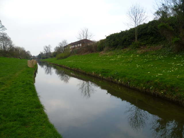
Image: © Marathon Taken: 8 Apr 2015
The New River was completed between 1609 and its official opening on 29th September 1613. It was designed to bring clean water to London at a time when the heavily-polluted River Thames was the main source of drinking water. Sir Hugh Myddleton devised a 40 mile course that followed the contours of the land and only dropped about two inches every mile. It ran from springs near Ware in Hertfordshire to New River Head near the Angel, Islington but now finishes at Stoke Newington. The New River remains an essential part of London’s water supply. The part to the south of Stoke Newington, where it survives, is more like a linear pond, but from Green Lanes upriver the water still flows as it has done for over 400 years. Much of it is followed by the New River Path as here. This photograph is taken from just upriber of the Bowes Park Tunnel, accessed here from Myddleton Road. The tunnel was built during 1857 and 1858 and came into use in 1859. It is over half a mile long and three and a half million London stock bricks were used. The tunnel is listed and was repaired and restored between August and October 2011. To mark its 150th anniversary a very interesting collection of information posters have been put up in the small open space between Myddleton Road and the top of the tunnel. One of these can be seen at http://www.geograph.org.uk/photo/4420818
Images are licensed for reuse under creativecommons.org/licenses/by-sa/2.0
Image Location
Latitude
51.607294
Longitude
-0.115877