Watford Underground Station
Introduction
The photograph on this page of Watford Underground Station by Ed of the South as part of the Geograph project.
The Geograph project started in 2005 with the aim of publishing, organising and preserving representative images for every square kilometre of Great Britain, Ireland and the Isle of Man.

There are currently over 7.5m images from over 14,400 individuals and you can help contribute to the project by visiting https://www.geograph.org.uk
Watford Underground Station
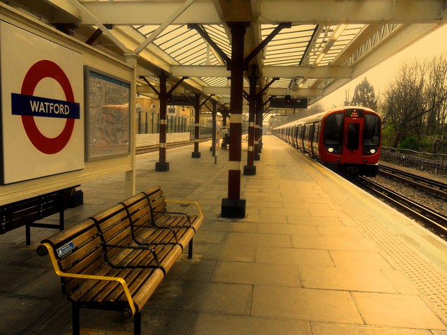
Image: © Ed of the South Taken: 8 Apr 2015
View along platform 1 of Watford underground station on the Metropolitan line, whilst it is still in existence. The progression of the Croxley-Watford Junction rail link, expected to be running by 2018, would eventually see the Metropolitan line divert after Croxley, onto the disused Croxley Green branch line through to Watford Junction. In the process, the line to the current Watford terminus would be closed to passengers.
Images are licensed for reuse under creativecommons.org/licenses/by-sa/2.0
Image Location
Latitude
51.656631
Longitude
-0.418446