A Yarnold Sangar or Yarnold shelter at RAF Wattisham
Introduction
The photograph on this page of A Yarnold Sangar or Yarnold shelter at RAF Wattisham by Adrian S Pye as part of the Geograph project.
The Geograph project started in 2005 with the aim of publishing, organising and preserving representative images for every square kilometre of Great Britain, Ireland and the Isle of Man.

There are currently over 7.5m images from over 14,400 individuals and you can help contribute to the project by visiting https://www.geograph.org.uk
A Yarnold Sangar or Yarnold shelter at RAF Wattisham
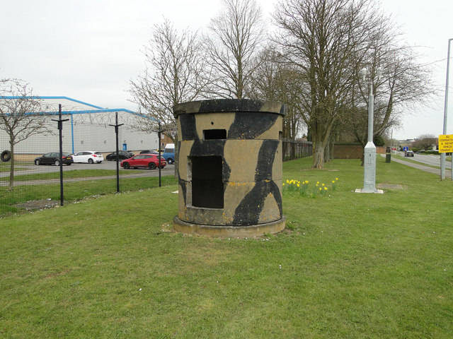
Image: © Adrian S Pye Taken: 8 Apr 2015
Named after the inventor they were prefabricated by Amey Roadstone during the Cold War period. Only effective against rifle fire they could be penetrated by concentrated machine gun fire.
Images are licensed for reuse under creativecommons.org/licenses/by-sa/2.0
Image Location
Latitude
52.123077
Longitude
0.967764