Penrhys bench with a view towards Llwynypia
Introduction
The photograph on this page of Penrhys bench with a view towards Llwynypia by Jaggery as part of the Geograph project.
The Geograph project started in 2005 with the aim of publishing, organising and preserving representative images for every square kilometre of Great Britain, Ireland and the Isle of Man.

There are currently over 7.5m images from over 14,400 individuals and you can help contribute to the project by visiting https://www.geograph.org.uk
Penrhys bench with a view towards Llwynypia
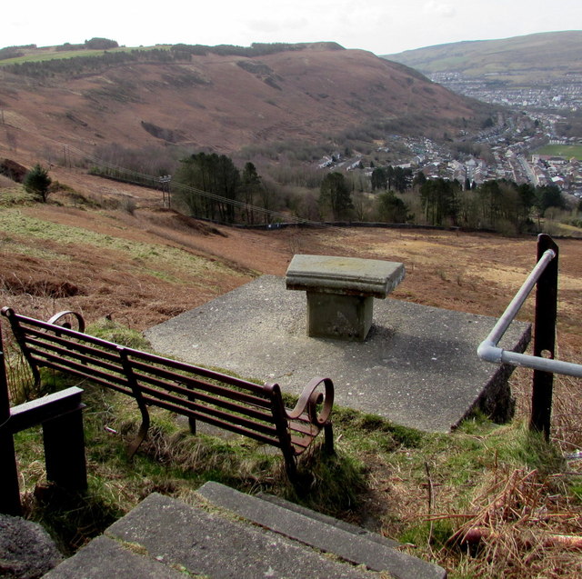
Image: © Jaggery Taken: 30 Mar 2015
At a height of 275 metres (900 ft) above sea level, the bench at the edge of the B4512 Penrhys Road commands views http://www.geograph.org.uk/photo/4419137 towards Llwynypia in the valley of the Rhondda Fawr river. The directions and locations information on the tablet in front of the bench have faded to illegibility.
Images are licensed for reuse under creativecommons.org/licenses/by-sa/2.0
Image Location
Latitude
51.641297
Longitude
-3.44522