Haywards Heath Station
Introduction
The photograph on this page of Haywards Heath Station by Simon Carey as part of the Geograph project.
The Geograph project started in 2005 with the aim of publishing, organising and preserving representative images for every square kilometre of Great Britain, Ireland and the Isle of Man.

There are currently over 7.5m images from over 14,400 individuals and you can help contribute to the project by visiting https://www.geograph.org.uk
Haywards Heath Station
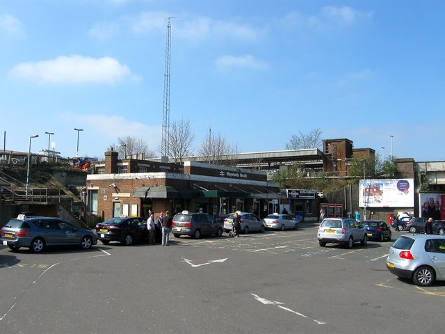
Image: © Simon Carey Taken: 7 Apr 2015
A view of the entrance from Commercial Square. Opened in the 1930s it replaced the old entrance that was located a little to the south and accessed down what is now Clair Road and coincided with the electrification of the London-Brighton line. The entrance is about to undergo another change as Network Rail is about to start work to modernise it and the station surroundings which will include a multi-storey car park in the old goods yard to double the number of parking places, a new footbridge linking the east and west sides of the station, and a new Waitrose on the corner of Perrymount Road and Commercial Square.
Images are licensed for reuse under creativecommons.org/licenses/by-sa/2.0
Image Location
Latitude
51.005674
Longitude
-0.104722