Battersea from the air
Introduction
The photograph on this page of Battersea from the air by Thomas Nugent as part of the Geograph project.
The Geograph project started in 2005 with the aim of publishing, organising and preserving representative images for every square kilometre of Great Britain, Ireland and the Isle of Man.

There are currently over 7.5m images from over 14,400 individuals and you can help contribute to the project by visiting https://www.geograph.org.uk
Battersea from the air
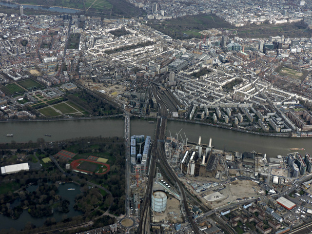
Image: © Thomas Nugent Taken: 1 Apr 2015
Battersea Park is on the left, with the disused power station and gas works on the right. Victoria railway station can be seen across the Thames.
Images are licensed for reuse under creativecommons.org/licenses/by-sa/2.0
Image Location
Latitude
51.478222
Longitude
-0.147842