Hendre Farm and adjacent building, Thornhill
Introduction
The photograph on this page of Hendre Farm and adjacent building, Thornhill by Kev Griffin as part of the Geograph project.
The Geograph project started in 2005 with the aim of publishing, organising and preserving representative images for every square kilometre of Great Britain, Ireland and the Isle of Man.

There are currently over 7.5m images from over 14,400 individuals and you can help contribute to the project by visiting https://www.geograph.org.uk
Hendre Farm and adjacent building, Thornhill
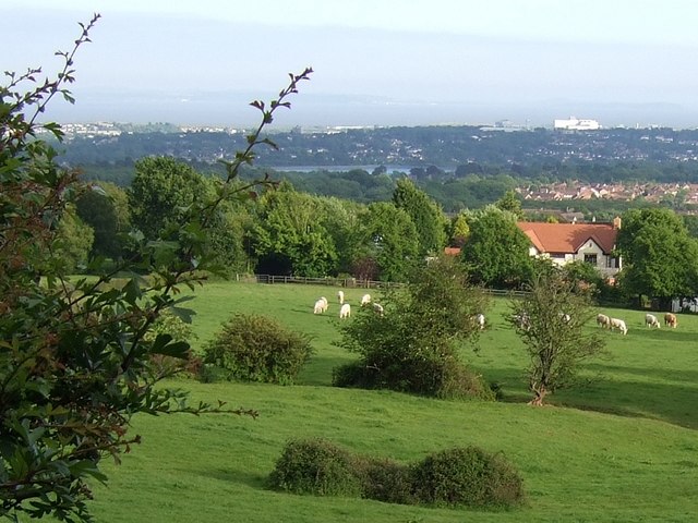
Image: © Kev Griffin Taken: 22 May 2007
The picture shows land belonging to Hendre Farm, however the building itself is a property adjacent to it. The body of water you see in the middle distance is Llanishen Reservoir. Taken from the Graig Llanishen Footpath.
Images are licensed for reuse under creativecommons.org/licenses/by-sa/2.0
Image Location


Leaflet Map data © OpenStreetMap
Latitude
51.550856
Longitude
-3.196005