East side of Ogney Brook ford, Llantwit Major
Introduction
The photograph on this page of East side of Ogney Brook ford, Llantwit Major by Jaggery as part of the Geograph project.
The Geograph project started in 2005 with the aim of publishing, organising and preserving representative images for every square kilometre of Great Britain, Ireland and the Isle of Man.

There are currently over 7.5m images from over 14,400 individuals and you can help contribute to the project by visiting https://www.geograph.org.uk
East side of Ogney Brook ford, Llantwit Major
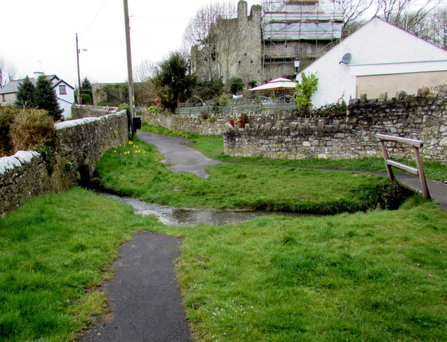
Image: © Jaggery Taken: 3 Apr 2015
An unnamed street from Turkey Street on this side to Castle Street fords Ogney Brook. A footbridge on the right gives walkers an alternative to walking through, or jumping across, the ford. Based on a tiny sample of about five minutes, this does not appear to be a busy route for vehicles, judging by the total of zero that crossed the ford.
Images are licensed for reuse under creativecommons.org/licenses/by-sa/2.0
Image Location
Latitude
51.410933
Longitude
-3.487263