Clyde Circus
Introduction
The photograph on this page of Clyde Circus by Marathon as part of the Geograph project.
The Geograph project started in 2005 with the aim of publishing, organising and preserving representative images for every square kilometre of Great Britain, Ireland and the Isle of Man.

There are currently over 7.5m images from over 14,400 individuals and you can help contribute to the project by visiting https://www.geograph.org.uk
Clyde Circus
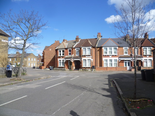
Image: © Marathon Taken: 31 Mar 2015
Clyde Circus is seen here from Clyde Road. Clyde Circus has a circular group of houses in the middle with small back gardens and what looks like a central communal area. The central feature is Clyde Circus itself laid out in the late 18th century as the centre piece of a grand approach from Tottenham Green to the east to the former Downhills House to the west. The very interesting Haringey Council web site about the Conservation Area (of which Clyde Circus is the centre piece) has a series of Ordnance Survey Maps which show that although the Circus was here much earlier the houses were not built at the time of the 1894-96 Ordnance Survey Map but appeared on the 1915 Ordnance Survey Map.
Images are licensed for reuse under creativecommons.org/licenses/by-sa/2.0
Image Location
Latitude
51.587962
Longitude
-0.077123