Benchmark on St Paul's Church
Introduction
The photograph on this page of Benchmark on St Paul's Church by Shantavira as part of the Geograph project.
The Geograph project started in 2005 with the aim of publishing, organising and preserving representative images for every square kilometre of Great Britain, Ireland and the Isle of Man.

There are currently over 7.5m images from over 14,400 individuals and you can help contribute to the project by visiting https://www.geograph.org.uk
Benchmark on St Paul's Church
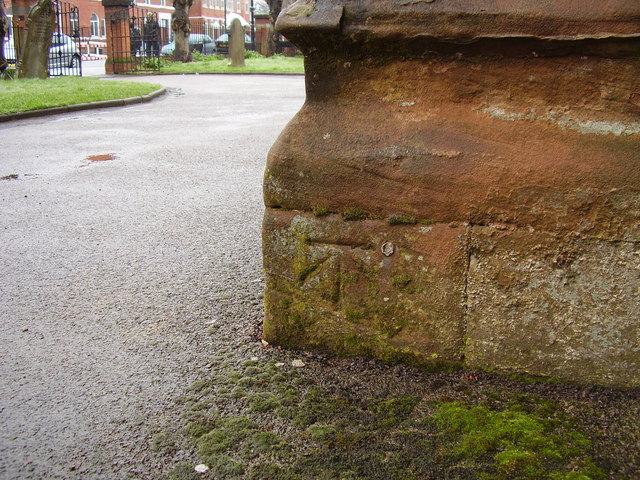
Image: © Shantavira Taken: 3 Apr 2015
This bench mark was established in 1848 during the First primary levelling of England & Wales, and was levelled with a height of 328.4780 feet [100.1201 metres] above mean sea level (Liverpool datum). It was included on the Birmingham to London (Branch Levelling [from Coventry] to Foleshill and Sow Churches, &c.) levelling line. The surveyor's description was "No. 5. Foleshill Church. Bolt in North-west angle; 1.21 ft. above surface" (p.231). Much of the church was destroyed during World War II, but the present church incorporates the original 1841 tower.
Images are licensed for reuse under creativecommons.org/licenses/by-sa/2.0
Image Location
Latitude
52.427277
Longitude
-1.50008