Housing development at Possil Road / Craighall Road
Introduction
The photograph on this page of Housing development at Possil Road / Craighall Road by Lairich Rig as part of the Geograph project.
The Geograph project started in 2005 with the aim of publishing, organising and preserving representative images for every square kilometre of Great Britain, Ireland and the Isle of Man.

There are currently over 7.5m images from over 14,400 individuals and you can help contribute to the project by visiting https://www.geograph.org.uk
Housing development at Possil Road / Craighall Road
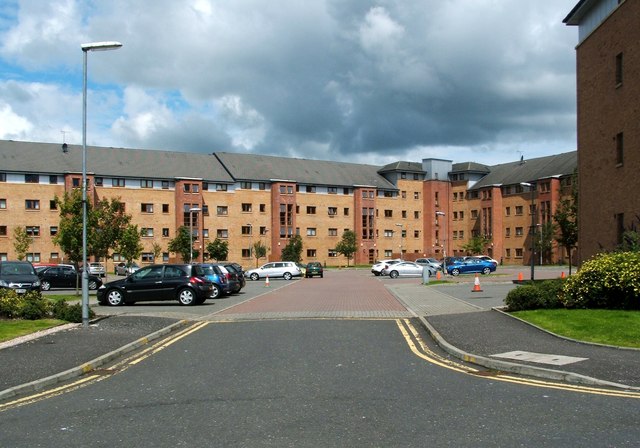
Image: © Lairich Rig Taken: 19 Jul 2011
When this picture was taken, the buildings had been there for only a few years (work was completed here about mid-2005); there are about 130 individual homes. The area is bounded on three sides by Possil Road, Craighall Road, and Dawson Road. The cobbled lane shown in Image leads here; in fact, some of the buildings in this development can be seen indistinctly in that picture, behind trees at the far end of the lane.
Images are licensed for reuse under creativecommons.org/licenses/by-sa/2.0
Image Location
Latitude
55.877343
Longitude
-4.255691