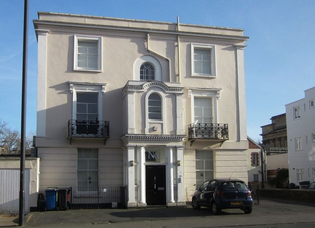
Building on St Paul's Road, Bristol
Introduction
The photograph on this page of Building on St Paul's Road, Bristol by Derek Harper as part of the Geograph project.
The Geograph project started in 2005 with the aim of publishing, organising and preserving representative images for every square kilometre of Great Britain, Ireland and the Isle of Man.
There are currently over 7.5m images from over 14,400 individuals and you can help contribute to the project by visiting https://www.geograph.org.uk

Image: © Derek Harper Taken: 22 Mar 2015
This is the end terrace of Image], a photo taken a few hours earlier when this façade was in shadow. It is described at http://list.historicengland.org.uk/resultsingle.aspx?uid=1202608&searchtype=mapsearch thus "A symmetrical 3-window right-hand return has a banded ground floor, semicircular-arched recess covered by a late C19 two-storey porch with Tuscan columns, glazed sides and C20 door, dentil cornice, clasping pilasters above to a bracketed cornice with a segmental arch and semicircular panel. Semicircular-arched stair window above".

