Narrowboat and Dunstall Water Bridge near Wolverhampton
Introduction
The photograph on this page of Narrowboat and Dunstall Water Bridge near Wolverhampton by Roger D Kidd as part of the Geograph project.
The Geograph project started in 2005 with the aim of publishing, organising and preserving representative images for every square kilometre of Great Britain, Ireland and the Isle of Man.

There are currently over 7.5m images from over 14,400 individuals and you can help contribute to the project by visiting https://www.geograph.org.uk
Narrowboat and Dunstall Water Bridge near Wolverhampton
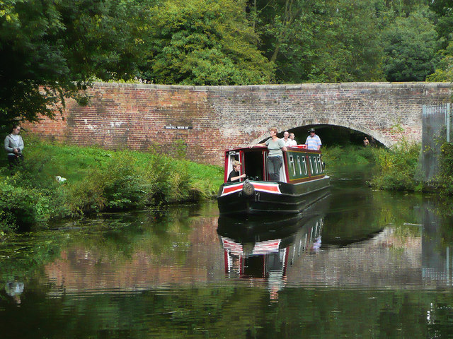
Image: © Roger D Kidd Taken: 30 Aug 2010
Bridge No 63 across the Staffordshire and Worcestershire Canal. The Smestow Brook is routed across the canal here by Dunstall Park Racecourse. The name of the Dunstall neighbourhood was already widely used by late Victorian times, but this bridge was built in the late eighteenth century, and is still plated with the original Tunstall spelling. http://www.blackcountrybugle.co.uk/Wolverhamptons-lost-village-Woundon/story-20148821-detail/story.html Version without narrowboat: Image] Image]
Images are licensed for reuse under creativecommons.org/licenses/by-sa/2.0
Image Location
Latitude
52.603269
Longitude
-2.151302